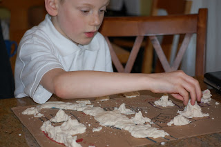


As I started reading through the history plans for next year, I saw one of the first activities was making a salt dough map. It sounded like quite a project for my crew. On the way home from school I proposed it as our project for the boys and they were super excited. The plan was to make maps of Europe and we started out with 4 big pieces of cardboard, lots of markers, an atlas, and plenty of enthusiasm but then Mr. 6 decided what he really wanted to make was Droidworld and Mr. 8 asked if he could make an imaginary map as well of I was the only one who actually made a map of Europe. Mr. 2's map did have a river and a lot of yellow so perhaps that was Europe as well. It was a bit hard to tell. It took us three batches of dough to cover the maps but I think everyone added all the landmarks they needed. Now they're all drying and will be ready for painting tomorrow. Next year I will have to enforce actually making maps of real places but we had fun and even ended the night with a dance party. It was either that or Mr. 6 was going to keep doing "time laps" around the house to burn off his excess energy. An entire week of rain and we'll needed padded walls for him to bounce off!

We made salt dough maps of Israel this year. The kids loved making the maps, but they had no interest in painting them. Frankly, neither did I - much less mess! I think Second Daughter made a turtle that day.
ReplyDeletePersonally, I think salt dough maps are best for learning about geographical features like mountains and valleys. If you're just looking to learn major cities or political boundaries, I prefer regular old flat paper maps. It's nice to mix it up.